Skip to content
County Clare — photo by The Banner
Ireland › Counties › Clare

County Clare

An Clár

Munster · 252 places · 68 photos · 9 videos

Hero photo: The Banner · CC BY-SA 3.0

About County Clare

County Clare ( CLAIR, Irish: Contae an Chláir) is a county in the province of Munster in the Southern part of Ireland, bordered on the west by the Atlantic Ocean. Clare County Council is the local authority. The county had a population of 127,938 at the 2022 census. The county seat and largest settlement is Ennis.

Intro from Wikipedia (CC BY-SA 4.0)

Explore Clare by category

Top 10 must-sees in Clare

View list page →
Burren National Park — photo by The Banner #1

Burren National Park

Burren National Park (Irish: Páirc Náisiúnta Bhoirne) is one of eight national parks in Ireland managed by the National Parks and Wildlife Service. It covers a small part of the Burren, a karst landscape in County Clare. Burren National Park was founded and opened to the public in 1991. It features 1,500 hectares of mountains, bogs, heaths, grasslands and forests. The park is the smallest of Ireland's national parks.

Popularity
56
Explore place →
Aillwee Cave — photo by MarvinVells #2

Aillwee Cave

Aillwee Cave (Irish: Aill Bhuí) is a cave system in the karst landscape of the Burren in County Clare, Ireland. The name Aillwee is derived from the Irish Aill Bhuí which means "yellow cliff". Privately owned, it forms part of the Aillwee Cave and Birds of Prey Centre attraction.

Popularity
55
Explore place →
Doolin Cave — photo by P.hammer #3

Doolin Cave

Doolin Cave (Irish: Pol an Ionain or Poll-an-Ionain) is a limestone cave near Doolin in County Clare, Ireland, on the western edge of The Burren. The name is the anglicised version of the Irish name Poll an Eidhneáin, which is said to translate into "Ivy Cliff Cave". The cave attracted some controversy due to its development and marketing as a show cave in the early 21st century. It is now open to the public, branded as Doolin Cave.

Popularity
50
Explore place →
Ailladie — photo by The original uploader was Rwxrwxrwx at English Wikipedia. #5

Ailladie

Ailladie (Irish: Aill an Daill, lit. 'Blind Man's Cliff'; also known locally as the Ballyreen Cliffs), is an 800-metre-long (2,600 ft) west-facing limestone sea cliff, that varies in height from 8 metres (26 ft) to 35 metres (115 ft), situated on the coast of The Burren in County Clare, Ireland. Ailladie is one of Ireland's most highly regarded rock-climbing locations, particularly for high technical grade single pitch traditional climbing routes and deep-water soloing routes. It is also a location for shore-angling competitions, and, with its cliffs and view of the Aran Islands, is a popular photography stop for tourists.

Popularity
42
Explore place →
Mullagh More — photo by Paul Woods #6

Mullagh More

Mullaghmore (Irish: Mullach Mór, meaning 'Great Summit') is a 180 metres (590 ft) limestone hill in The Burren in Glenquin, Kilnaboy County Clare, Ireland. It is part of a hiking trail called the Mullaghmore Loop in the Burren National Park.

Popularity
41
Explore place →
Slievecallan — photo by Eddylandzaat #8

Slievecallan

Slievecallan or Slieve Callan (Irish: Sliabh Calláin), also historically called 'Mount Callan', is a mountain with a height of 391 metres (1,283 ft) in west County Clare, Ireland. It is the third highest mountain in the county. There is a small lake and two megalithic tombs on the south side, and traditionally the mountain was used for Lughnasa gatherings.

Popularity
35
Explore place →
Church Dysert O’Dea
#9

Dysert O’Dea

Dysert O'Dea Church (Irish: Díseart Uí Dheá - "the hermitage of Deá") near Corofin in County Clare, Ireland stands on the site of an early Christian monastery which is thought to have been founded by St. Tola in the 8th century. Most of the present structures are from the 12th century. The site has been designated a National Monument of Ireland.

Popularity
33
Explore place →
Maghera — photo by colm #10

Maghera

The Maghera transmission site is situated on a 400 metre (1000 foot) hill (Irish: Cnoc an Ois) located at Killanena in the east of County Clare, Ireland. It is home to one of 2RN's network of radio and television transmitters.

Popularity
32
Explore place →

Videos from Clare

Burren National Park , County Clare , IRELAND 4K

Burren National Park , County Clare , IRELAND 4K

Bruno & Company

Burren National Park →
Aillwee Cave & Birds of Prey Centre

Aillwee Cave & Birds of Prey Centre

Burren Ecotourism Network

Aillwee Cave →
Doolin Cave, Ireland (4K)

Doolin Cave, Ireland (4K)

Exploring Europe

Doolin Cave →
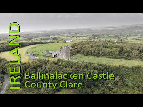
Ireland’s Hidden Castles ☘️ Medieval Ballinalacken Castle

Ireland’s Hidden Castles ☘️ Medieval Ballinalacken Castle

Flying over the World

Ballinalacken Castle →
Climbing Black widow (HVS) in Ailladie - Ireland

Climbing Black widow (HVS) in Ailladie - Ireland

thecathouse

Ailladie →
Knockaines, Slieve Roe, Mullagh More, Goats

Knockaines, Slieve Roe, Mullagh More, Goats

Craig Mitchell

Mullagh More →

All places in Clare

Showing 24 of 252 places

Burren National Park — photo by The Banner▶ Video
National ParkClare

Burren National Park

Burren National Park (Irish: Páirc Náisiúnta Bhoirne) is one of eight national parks in Ireland managed by the National Parks and Wildlife Service. It covers a small part of the Burren, a karst landscape in County Clare. Burren National Park was founded and opened to the public in 1991. It features 1,500 hectares of mountains, bogs, heaths, grasslands and forests. The park is the smallest of Ireland's national parks.

Aillwee Cave — photo by MarvinVells▶ Video
CaveClare

Aillwee Cave

Aillwee Cave (Irish: Aill Bhuí) is a cave system in the karst landscape of the Burren in County Clare, Ireland. The name Aillwee is derived from the Irish Aill Bhuí which means "yellow cliff". Privately owned, it forms part of the Aillwee Cave and Birds of Prey Centre attraction.

Doolin Cave — photo by P.hammer▶ Video
CaveClare

Doolin Cave

Doolin Cave (Irish: Pol an Ionain or Poll-an-Ionain) is a limestone cave near Doolin in County Clare, Ireland, on the western edge of The Burren. The name is the anglicised version of the Irish name Poll an Eidhneáin, which is said to translate into "Ivy Cliff Cave". The cave attracted some controversy due to its development and marketing as a show cave in the early 21st century. It is now open to the public, branded as Doolin Cave.

Ballinalacken Castle — photo by No machine-readable author provided. Bogman assumed (based on copyright claims).▶ Video
CastleClare

Ballinalacken Castle

Ballinalacken Castle is a two-stage tower house located in Killilagh parish of County Clare, Ireland. It is of uncertain date but most likely was built in the 15th or early 16th century.

Ailladie — photo by The original uploader was Rwxrwxrwx at English Wikipedia.▶ Video
CliffClare

Ailladie

Ailladie (Irish: Aill an Daill, lit. 'Blind Man's Cliff'; also known locally as the Ballyreen Cliffs), is an 800-metre-long (2,600 ft) west-facing limestone sea cliff, that varies in height from 8 metres (26 ft) to 35 metres (115 ft), situated on the coast of The Burren in County Clare, Ireland. Ailladie is one of Ireland's most highly regarded rock-climbing locations, particularly for high technical grade single pitch traditional climbing routes and deep-water soloing routes. It is also a location for shore-angling competitions, and, with its cliffs and view of the Aran Islands, is a popular photography stop for tourists.

Mullagh More — photo by Paul Woods▶ Video
PeakClare

Mullagh More

Mullaghmore (Irish: Mullach Mór, meaning 'Great Summit') is a 180 metres (590 ft) limestone hill in The Burren in Glenquin, Kilnaboy County Clare, Ireland. It is part of a hiking trail called the Mullaghmore Loop in the Burren National Park.

Moylussa — photo by Chris55 at English Wikipedia▶ Video
PeakClare

Moylussa

Moylussa (Irish: Maigh Lusa) is a mountain in the Slieve Bernagh range in western Ireland, and the highest point in County Clare at 532 metres (1,745 ft).

Slievecallan — photo by Eddylandzaat
PeakClare

Slievecallan

Slievecallan or Slieve Callan (Irish: Sliabh Calláin), also historically called 'Mount Callan', is a mountain with a height of 391 metres (1,283 ft) in west County Clare, Ireland. It is the third highest mountain in the county. There is a small lake and two megalithic tombs on the south side, and traditionally the mountain was used for Lughnasa gatherings.

ChurchDysert O’Dea
ChurchClare

Dysert O’Dea

Dysert O'Dea Church (Irish: Díseart Uí Dheá - "the hermitage of Deá") near Corofin in County Clare, Ireland stands on the site of an early Christian monastery which is thought to have been founded by St. Tola in the 8th century. Most of the present structures are from the 12th century. The site has been designated a National Monument of Ireland.

Maghera — photo by colm
PeakClare

Maghera

The Maghera transmission site is situated on a 400 metre (1000 foot) hill (Irish: Cnoc an Ois) located at Killanena in the east of County Clare, Ireland. It is home to one of 2RN's network of radio and television transmitters.

Caisléan Muicinis Nua — photo by C Michael Hogan
CastleClare

Caisléan Muicinis Nua

Shanmuckinish Castle (or Seanmuckinish Castle) (Muck inis, Irish for pig island) is a ruined tower house located in Drumcreehy civil parish of County Clare, Ireland.

CliffCliffs of Moher
▶ Video
CliffClare

Cliffs of Moher

The Cliffs of Moher (; Irish: Aillte an Mhothair) are sea cliffs located at the southwestern edge of the Burren region in County Clare, Ireland. They run for about 14 kilometres (9 miles). At their southern end, they rise 120 metres (390 ft) above the Atlantic Ocean at Hag's Head, and, 8 kilometres (5 miles) to the north, they reach their maximum height of 214 metres (702 ft) just north of O'Brien's Tower, a round stone tower near the midpoint of the cliffs, built in 1835 by Sir Cornelius O'Brien, then continue at lower heights. The closest settlements are the villages of Liscannor 6 km (4 miles) to the south, and Doolin 7 km (4 miles) to the north. From the cliffs, and from atop the tower, visitors can see the Aran Islands in Galway Bay, the Maumturks and Twelve Pins mountain ranges to the north in County Galway, and Loop Head to the south. The cliffs rank among the most visited tourist sites in Ireland, with around 1.5 million visits per year.

Cromlech — photo by Andreas F. Borchert
Archaeological SiteClare

Cromlech

Parknabinnia wedge tomb is a prehistoric wedge tomb located in the Burren area of County Clare, Ireland.

Ballyryan — photo by Andy Waddington
CliffClare

Ballyryan

Ballyryan or Ballyreen (Irish: Baile Uí Rinn; Ring's homestead) is a small inland mostly west-facing limestone crag in The Burren in County Clare, Ireland. It is popular with rock climbers due to its easy access, the range of short easy-to-intermediate rock climbs, and its close proximity to the much larger and highly regarded, Ailladie rock-climbing sea-cliff; Ailladie is also locally known as the Ballyreen Cliffs or Ballyreen Point.

Poulawack Cairn — photo by Aiden Clarke
Archaeological SiteClare

Poulawack Cairn

Poulawack Cairn is a prehistoric burial cairn located in the Burren area of County Clare, Ireland.

Caherconnell Stone Fort — photo by Ingo Mehling
RuinsClare

Caherconnell Stone Fort

Caherconnell (Irish: Cathair Chonaill, meaning 'Conall's stone ringfort') is an exceptionally well-preserved medieval stone ringfort in region known as the Burren, County Clare, Ireland. It lies about 1 km south of the Poulnabrone dolmen.

Castle Baun — photo by Roger Diel
CastleClare

Castle Baun

Castlebawn is a 16th-century tower house, in County Clare, Ireland. It is on a small island on Lough Derg on the River Shannon, it is connected to the shore of Bealkelly by a man-made causeway. It was built by the McNamaras about 1540, severely damaged in 1827, but is now restored although public access is not permitted to the castle.

Creevagh Tomb — photo by Jtonra
Archaeological SiteClare

Creevagh Tomb

Creevagh wedge tomb is a prehistoric wedge tomb located in the Burren area of County Clare, Ireland.

Doonagore Castle — photo by Valfex
CastleClare

Doonagore Castle

Doonagore Castle is a round 16th-century tower house with a small walled enclosure located about 1 km south of the coastal village of Doolin in County Clare, Ireland. Its name may be derived from Dún na Gabhair, meaning "the fort of the rounded hills" or the "fort of the goats". Doonagore Castle is at present a private holiday home, inaccessible to the public. Doonagore Castle sits on a hill overlooking Doolin Point and, along with a nearby higher radio mast, is used as a navigational point by boats approaching Doolin Pier. It is located in the townland of Doonagore, parish of Killilagh, County Clare. It is sometimes considered to be located in the area known as the Burren.[1]:99

MegalithPoulnabrone Dolmen
MegalithClare

Poulnabrone Dolmen

Poulnabrone dolmen (Irish: Poll na Brón, lit. 'Hole of the Quernstone') is a large dolmen (or cromlech, a type of single-chamber portal tomb) located in the Burren, County Clare, Ireland. Situated on one of the region's most desolate and highest points, it comprises three standing portal stones supporting a heavy horizontal capstone and dates to the early Neolithic period, with estimates from 3800 and 3200 BC. Although not the largest, it is the best known of the approximately 172 dolmens in Ireland. It was constructed on a unique karst landscape formed from limestone laid down around 350 million years ago. The dolmen was built by Neolithic farmers, choosing the location either for ritual, as a territorial marker, or as a collective burial site. What remains today is only the "stone skeleton" of the original monument; originally, it would have been covered with soil, and its flagstone capped by a cairn. When the site was excavated in 1986 and again in 1988, around 33 human remains, including those of adults and children (including the remains of a much later Bronze Age infant), were found buried underneath it. Researchers also discovered various stone and bone objects that would have been placed with the dead at the time of interment. The human remains and objects are estimated to have been buried intermittently during the 600-year period between 3800 and 3200 BC.

CastleBunratty Castle
CastleClare

Bunratty Castle

Bunratty Castle (Irish: Caisleán Bhun Raithe) is a large 15th-century tower house in County Clare, Ireland. It is located in the centre of Bunratty village, by the N18 road between Limerick and Ennis, near Shannon Town and its airport.

CastleGleninagh Castle
CastleClare

Gleninagh Castle

Gleninagh or Glaninagh (Irish: Gleann Eidhneach) is a civil parish in County Clare, Ireland. It lies in the extreme northwest of the Burren, on the south of the mouth of Galway Bay. It is known for the well-preserved L-plan Gleninagh Castle, a 16th-century tower house. The parish also contains the lighthouse on Black Head.

O'Brien's Tower — photo by Frabjousone
GeneralClare

O'Brien's Tower

O'Brien's Tower marks the highest point of the Cliffs of Moher in County Clare, Ireland. It is located a short distance from the villages Doolin and Liscannor. It is one of the most photographed Irish landmarks.

More counties in Munster