Skip to content
County Donegal — photo by Kay Atherton
Ireland › Counties › Donegal

County Donegal

Dún na nGall

Ulster · 428 places · 92 photos · 18 videos

Hero photo: Kay Atherton · CC BY-SA 2.0

About County Donegal

County Donegal ( DUN-ig-AWL, DON-ig-AWL; Irish: Contae Dhún na nGall) is a county in the Republic of Ireland. It is in the province of Ulster and is the northernmost county on the island of Ireland. The county mostly borders Northern Ireland, sharing only a small border with one county of the rest of the Republic; its nickname is "The Forgotten County". The county, the fourth-largest, is named after the town of Donegal in the south, although Lifford is the county town. It has also been known as County Tyrconnell or Tirconaill (Tír Chonaill), after the historical territory on which, along with Inishowen, it was based. Its territory hosted one of the most powerful families of late Gaelic Ireland, the O'Donnells. Donegal County Council is the local council. The population was 167,084 at the 2022 census. Donegal is home to a Gaeltacht community, notably including Gweedore, and contains centres of traditional cultural activity; it is the home county of Clannad and Enya. Mountains and cliffs feature, and the county has one of the longest coastlines on the island of Ireland.

Intro from Wikipedia (CC BY-SA 4.0)

Explore Donegal by category

Top 10 must-sees in Donegal

View list page →
Sliabh Liag — photo by Tony Webster from Portland, Oregon, United States #1

Sliabh Liag

Slieve League (Irish: Sliabh Liag, meaning 'mountain of stone pillars') is a mountain on the Atlantic coast of County Donegal, Ireland. At 601 metres (1,972 ft), it has the second-highest sea cliffs in Ireland, after Croaghaun, and some of the highest sea cliffs in Europe. In his 1937 memoir The Way That I Went, the Irish naturalist Robert Lloyd Praeger wrote of the location: A tall mountain of nearly 2000 feet, precipitous on its northern side, has been devoured by the sea till the southern face forms a precipice likewise, descending on this side right into the Atlantic from the long knife-edge which forms the summit. The traverse of this ridge, the "One Man's Path", is one of the most remarkable walks to be found in Ireland - not actually dangerous, but needing a good head and careful progress on a stormy day....The northern precipice, which drops 1500 feet into the coomb surrounding the Little Lough Agh, harbours the majority of the alpine plants of Slieve League, the most varied group of alpines to be found anywhere in Donegal. Slieve League is often photographed from a viewpoint known as Bunglass. It can be reached by means of a narrow road that departs from Teelin. The final few kilometres of the route are built along a precipice and include several places at which the road turns at the crest of a rise.

Popularity
73
Explore place →
Páirc Naisiúnta Ghleann Bheatha - Glenveagh National Park — photo by Patrice78500 #2

Páirc Naisiúnta Ghleann Bheatha - Glenveagh National Park

Glenveagh ( glen-VAY; Irish: Gleann Bheatha, meaning 'glen of the birches') is the second-largest national park in all of Ireland. Located in County Donegal, it includes: Glenveagh Castle and its grounds; Lough Veagh; and much of the Derryveagh Mountains. National parks in Ireland conform to IUCN standards. As of 2024, Glenveagh is the only national park anywhere in Ulster, the northern province in Ireland.

Popularity
66
Explore place →
Muckish — photo by C.B.Doak (user Zorba the Geek) #3

Muckish

Muckish (Irish: Mucais / an Mhucais, meaning '[the] pig's back') is a distinctive flat-topped mountain in the Derryveagh Mountains of County Donegal, Ireland. At 667.1 metres (2,189 ft), it is the third-highest peak in the Derryveagh Mountains and the 163rd highest in Ireland. Muckish is also the most northern and second highest of the mountain chain called the "Seven Sisters" by locals. The Seven Sisters are Muckish, Crocknalaragagh, Aghla Beg, Ardloughnabrackbaddy, Aghla More, Mackoght, and Errigal.

Popularity
59
Explore place →
Mac Uchta — photo by Colin Park #6

Mac Uchta

Mackoght or Macoght (from Irish Mac Uchta, meaning 'son of the mountain-breast'), also called Little Errigal or Wee Errigal (Irish: an Earagail Bheag), is a 555 metres (1,821 ft) high mountain in County Donegal, Ireland.

Popularity
37
Explore place →
An Earagail — photo by Patrice78500 #8

An Earagail

Errigal (Irish: An Earagail) is a 751-metre (2,464 ft) mountain near Gweedore in County Donegal, Ireland. It is the tallest peak of the Derryveagh Mountains and the tallest peak in County Donegal. Errigal is also the most southern and the highest of the mountain chain called the "Seven Sisters" by locals. The other peaks of the Seven Sisters are Muckish, Crocknalaragagh, Aghla Beg, Ardloughnabrackbaddy, Aghla More, and Mackoght.

Popularity
28
Explore place →

Videos from Donegal

Exploring Ireland's Hidden Gem | Slieve League Cliffs  (Sliabh Liag) | Boat Tour and Cliff Hike

Exploring Ireland's Hidden Gem | Slieve League Cliffs (Sliabh Liag) | Boat Tour and Cliff Hike

Just Chasing Sunsets

Sliabh Liag →
Páirc Náisiúnta Ghleann Bheatha (Glenveagh National Park) #donegal #ireland #nature #shorts

Páirc Náisiúnta Ghleann Bheatha (Glenveagh National Park) #donegal #ireland #nature #shorts

Mike Dirth

Páirc Naisiúnta Ghleann Bheatha - Glenveagh National Park →
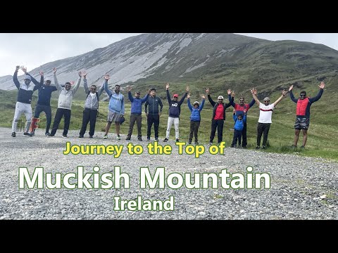
Journey to the Top of Muckish Mountain, Donegal, Ireland

Journey to the Top of Muckish Mountain, Donegal, Ireland

Techmedia Fun

Muckish →
Why Glenveagh Castle Is a Must See in Donegal, Ireland

Why Glenveagh Castle Is a Must See in Donegal, Ireland

The Dronehouse Chronicles: Ageless Creator

Glenveagh Castle →
Slí an Earagail 👣 3 Minute Trails

Slí an Earagail 👣 3 Minute Trails

Tough Soles

An Earagail →
Exploring Donegal, Ireland 🇮🇪 | Things to do

Exploring Donegal, Ireland 🇮🇪 | Things to do

This is Ireland

Grianan of Aileach →

All places in Donegal

Showing 24 of 428 places

Sliabh Liag — photo by Tony Webster from Portland, Oregon, United States▶ Video

Sliabh Liag

Slieve League (Irish: Sliabh Liag, meaning 'mountain of stone pillars') is a mountain on the Atlantic coast of County Donegal, Ireland. At 601 metres (1,972 ft), it has the second-highest sea cliffs in Ireland, after Croaghaun, and some of the highest sea cliffs in Europe. In his 1937 memoir The Way That I Went, the Irish naturalist Robert Lloyd Praeger wrote of the location: A tall mountain of nearly 2000 feet, precipitous on its northern side, has been devoured by the sea till the southern face forms a precipice likewise, descending on this side right into the Atlantic from the long knife-edge which forms the summit. The traverse of this ridge, the "One Man's Path", is one of the most remarkable walks to be found in Ireland - not actually dangerous, but needing a good head and careful progress on a stormy day....The northern precipice, which drops 1500 feet into the coomb surrounding the Little Lough Agh, harbours the majority of the alpine plants of Slieve League, the most varied group of alpines to be found anywhere in Donegal. Slieve League is often photographed from a viewpoint known as Bunglass. It can be reached by means of a narrow road that departs from Teelin. The final few kilometres of the route are built along a precipice and include several places at which the road turns at the crest of a rise.

Páirc Naisiúnta Ghleann Bheatha - Glenveagh National Park — photo by Patrice78500▶ Video
National ParkDonegal

Páirc Naisiúnta Ghleann Bheatha - Glenveagh National Park

Glenveagh ( glen-VAY; Irish: Gleann Bheatha, meaning 'glen of the birches') is the second-largest national park in all of Ireland. Located in County Donegal, it includes: Glenveagh Castle and its grounds; Lough Veagh; and much of the Derryveagh Mountains. National parks in Ireland conform to IUCN standards. As of 2024, Glenveagh is the only national park anywhere in Ulster, the northern province in Ireland.

Muckish — photo by C.B.Doak (user Zorba the Geek)▶ Video

Muckish

Muckish (Irish: Mucais / an Mhucais, meaning '[the] pig's back') is a distinctive flat-topped mountain in the Derryveagh Mountains of County Donegal, Ireland. At 667.1 metres (2,189 ft), it is the third-highest peak in the Derryveagh Mountains and the 163rd highest in Ireland. Muckish is also the most northern and second highest of the mountain chain called the "Seven Sisters" by locals. The Seven Sisters are Muckish, Crocknalaragagh, Aghla Beg, Ardloughnabrackbaddy, Aghla More, Mackoght, and Errigal.

Glenveagh Castle — photo by Chris Gunns▶ Video
CastleDonegal

Glenveagh Castle

Glenveagh Castle (Irish: Caisleán Ghleann Bheatha) is a large castellated mansion located in Glenveagh National Park, County Donegal, Ireland and was built in about 1870.

An Eachla Mhór — photo by Colin Park

An Eachla Mhór

Aghla More (Irish: An Eachla Mhór) is a mountain in County Donegal, Ireland with a height of 581 m (1,906 ft).

Mac Uchta — photo by Colin Park

Mac Uchta

Mackoght or Macoght (from Irish Mac Uchta, meaning 'son of the mountain-breast'), also called Little Errigal or Wee Errigal (Irish: an Earagail Bheag), is a 555 metres (1,821 ft) high mountain in County Donegal, Ireland.

An Earagail — photo by Patrice78500▶ Video

An Earagail

Errigal (Irish: An Earagail) is a 751-metre (2,464 ft) mountain near Gweedore in County Donegal, Ireland. It is the tallest peak of the Derryveagh Mountains and the tallest peak in County Donegal. Errigal is also the most southern and the highest of the mountain chain called the "Seven Sisters" by locals. The other peaks of the Seven Sisters are Muckish, Crocknalaragagh, Aghla Beg, Ardloughnabrackbaddy, Aghla More, and Mackoght.

Bocan Stone Circle — photo by Andreas F. Borchert
MegalithDonegal

Bocan Stone Circle

The Bocan Stone Circle is a stone circle situated near the village of Culdaff in the north of Inishowen, a peninsula on the north coast of County Donegal in Ulster, the northern province in Ireland.

Holywell Hill — photo by Greentide

Holywell Hill

The Holywell Hill transmission site is located on a 260-metre (853') hill near Killea in County Donegal, Ireland, and is owned and operated by 2RN (formerly RTÉ NL).

Raghtin More — photo by Andreas F. Borchert

Raghtin More

Raghtin More (Irish: Reachtain Mhór) or Slieve Keeroge is a mountain with a height of 502 metres (1,647 ft) in Inishowen, County Donegal, Ireland. There is a megalithic cairn on its summit, which can be climbed from Mamore Gap. From the summit there is a view of Lough Swilly and the coast stretching to Malin Head.

Grianan of Aileach — photo by Wikimedia Commons contributor▶ Video

Grianan of Aileach

The Grianán of Aileach ( GREE-nən əv AL-yə(kh); Irish: Grianán Ailigh [ˌɟɾʲiənˠaːnˠ ˈalʲiː]), sometimes anglicised as Greenan Ely or, locally, as Greenan Fort, is a hillfort atop the 244 metres (801 ft) high Greenan Mountain at Burt on the Inishowen Peninsula in County Donegal, Ireland. The main structure is a 19th-century reconstruction of a stone ringfort, thought to have been built by the Northern Uí Néill, in the sixth or seventh century CE; although there is evidence that the site had been in use before the fort was built. It has been identified as the seat of the Kingdom of Ailech and one of the royal sites of Gaelic Ireland. The wall is about 4.5 metres (15 ft) thick and 5 metres (16 ft) high. Inside it has three terraces, which are linked by steps, and two long passages within it. Originally, there would have been buildings inside the ringfort. Just outside it are the remains of a well and a tumulus. By the 12th century, the Kingdom of Ailech had become embattled and lost a fair amount of territory to the invading Normans. According to Irish literature, the ringfort was mostly destroyed by Muirchertach Ua Briain, King of Munster, in 1101. According to Tony Nugent, the Grianan was also used as a Mass rock during the anti-Catholic religious persecution that began under Henry VIII and ended only with Catholic Emancipation in 1829. Substantial restoration work was carried out in 1870. Today, the site is protected as a national monument and is a tourist attraction.

Doe Castle — photo by Original uploaded by Brendandh (Transfered by Lvova)
CastleDonegal

Doe Castle

Doe Castle, or Caisleán na dTuath, near Creeslough, County Donegal, was the historical stronghold of Clan tSuibhne (Clan McSweeney), with architectural parallels to the Scottish tower house. Built in the early 15th century, it is one of the better fortalices in the north-west of Ireland. The castle sits on a small peninsula, surrounded on three sides by water, with a moat cut into the rock of the landward side. The structure consists mainly of high outer walls around an interior bawn with a four-storey tower-house or keep.

Donegal Castle — photo by Benson Wills▶ Video
CastleDonegal

Donegal Castle

Donegal Castle (Irish: Caisleán Dhún na nGall) is a castle situated in the centre of Donegal Town in County Donegal in Ulster, the northern province in Ireland. The castle was the stronghold of the O'Donnell clan, Lords of Tír Conaill and one of the most powerful Gaelic families in Ireland from the 5th to the 16th centuries. For most of the last two centuries, the majority of the buildings lay in ruins but the castle was almost fully restored in the early 1990s. It is now open to the public.

Ard Loch na mBreac Beadaí — photo by Colin Park

Ard Loch na mBreac Beadaí

Ardloughnabrackbaddy (Irish: Ard Loch na mBreac Beadaí, meaning 'high lough of the dainty/saucy trout' ) is a mountain in County Donegal, Ireland, with a height of 472.5 m (1,550 ft).

An Chruach Ghorm — photo by John Cromie

An Chruach Ghorm

Croaghgorm or Bluestack (from Irish an Chruach Gorm, meaning 'the blue stack') is a 674-metre (2,211 ft) mountain in County Donegal, Ireland. It is the highest of the Blue Stack Mountains (or Croaghgorms) and the third-highest mountain in County Donegal. On 31 January 1944, during World War II, a Royal Air Force (RAF) Sunderland plane crashed on the mountain. Seven RAF crewmen from 228 Squadron were killed. Wreckage from the plane can still be seen on the mountain's slopes. A memorial plaque was unveiled in 1988.

Carrickabraghy Castle — photo by Kenneth Allen
CastleDonegal

Carrickabraghy Castle

Carrickabraghy Castle (Irish: Caisleán Charraig Bhrachaí stands in the townland of Carrickabraghy meaning "Friars Rock" in Irish) on a rocky outcrop at the north-western extremity of the Isle of Doagh, at the head of Pollan Bay, in the north of Inishowen, a peninsula on the north coast of County Donegal, Ireland. The townland and its castle are located in the Parish of Clonmany in the Barony of Inishowen East. Known as 'The Castles', the site is of local historical importance.

O'Doherty's Castle — photo by Kenneth Allen
RuinsDonegal

O'Doherty's Castle

Burt Castle is a ruined castle located close to Newtowncunningham and Burt, two villages in the east of County Donegal in Ulster, Ireland. Historically it was sometimes spelt as Birt Castle. It is also known by the name O'Doherty's Castle, and should not be mistaken for O'Doherty's Keep near Buncrana. The castle was constructed in the sixteenth century during the reign of Henry VIII. It was a traditional stronghold of the O'Doherty's, protecting the southern edge of their Inishowen Lordship. The design of the castle was strongly influenced by contemporary Z-Plan Scottish fortifications, and anticipated the style of buildings constructed during the Ulster Plantation of the following century. During a disputed succession in 1600, the Crown's Governor of Derry, Sir Henry Docwra, backed the successful candidate, the fifteen-year-old Sir Cahir O'Doherty. O'Doherty wished to break free of the overlordship of Red Hugh O'Donnell and fought on the Crown's side during the Nine Years' War and was knighted for his bravery. Burt Castle was a vital post because it controlled a strategic area, allowing Docwra to bring in food supplies and to open up an offensive again O'Donnell. A garrison of a hundred men under Captain John Vaughan were stationed there. Following the war O'Doherty continued in his loyalty to the Crown but in 1608, after a dispute with the new Governor of Derry, O'Doherty rose in revolt with the castle as his headquarters. The Burning of Derry in April triggered what became known as O'Doherty's Rebellion. In response the Dublin authorities sent troops to overrun O'Doherty's Inishowen heartlands. After a siege they captured Burt Castle and freed the prisoners taken at Derry who were being held there. Shortly afterwards O'Doherty was killed at the Battle of Kilmacrennan and the rebellion collapsed. During the Williamite War, the castle was the site of a skirmish between Jacobite forces and troops under the overall command of General Percy Kirke who were supporting William III.

Urris Hills — photo by Patrice78500

Urris Hills

Urris Hills is a natural peak located in County Donegal. It is categorized as a natural peak.

Beltany Stone Circle — photo by Mark Doherty
MegalithDonegal

Beltany Stone Circle

The Beltany stone circle is a Bronze Age stone circle just south of Raphoe town in County Donegal, Ireland. It dates from around 2100-700 BC. There is evidence that it may also have been the sacred site of Neolithic monuments, possibly early passage tombs. It overlooks the now destroyed passage tomb complex at Kilmonaster and Beltany is dominated by Croghan Hill to the east on the summit of which there sits a Neolithic mound most likely a passage tomb (though never excavated). Beltany is 145 feet across and has 64 stones (originally there would have been at least 80 stones) of varying height and width enclosing an earthen platform. The stones are large with some more than 6 feet in height. The centre is greatly disturbed and most likely was the result of digging by locals in the 1700s for available loose stones to build farmsteads and field boundaries. This evidence was given orally to the Ordnance Survey field officers in 1830s which is written into the OS records. It states that locals recalled the removal of vast heaps of stone and sepulchral type graves with bones. The boulder wall close to the circle may support this evidence and the mention in OS early maps of ‘Tops Village’ at the foot of the hill. The enigmatic Stone Circle is situated on the summit of Tops Hill, the anglicized Gaelic word meaning ‘the lighting of a ceremonial torch’. Several stones are cupmarked. One in particular, the triangle stone on NE is decorated with circular incisions or cup marks visible to naked eye. Other stones have what appears to be replicated star constellations. The heavy stones on NW lean outwards possibly from pressure of the earlier debris and boulders removed in 1700s or due to depletion of earthen bank. This was a ritual site associated with marking the agricultural Celtic year – the summer and winter Solstices and Equinox. The Celtic Ritual Year was in 4 parts – Beltaine (May), Samhain (November) the main parts and Imbolg (February) and Lughnasa (August). Beltany may be linked to marking both sunrise and sunset at these important ritual and ceremonial events in the year. It may also have a lunar orientation, yet to be calculated. A single ‘outlier’ stone about 2 metres high stands to the southeast of the circle. It probably had some function related to the rituals or ceremonies in the circle. Or it may be one of the several line standing stones found in fields around the slopes of Tops hill and valley. A carved stone head (flat to back) is believed to have come from lands around Beltany and thought to have functioned as either a mask or a mould from which ceremonial masks were fashioned in bronze or even gold. It is in the vaults at the National Museum in Dublin. These megaliths indicate that this landscape was marked out and used as a sacred and ritual site for several millennia. It has been suggested that the name of the site is linked to the Celtic festival of fertility known as 'Beltane', the anglicised name for the Gaelic May Day festival, commonly held on 1 May and historically, widely observed throughout Ireland, Scotland and the Isle of Man. In Irish the name for the festival day is Lá Bealtaine, in Scottish Gaelic Là Bealltainn and in Manx Gaelic Laa Boaltinn/Boaldyn.

Fort Dunree Military Museum — photo by Irishhistoricalgamer
MuseumDonegal

Fort Dunree Military Museum

Fort Dunree (Irish: An Dún Riabhach, meaning 'Grey Fort' or Dún Fhraoigh meaning "Fort of Heather") is a coastal defence fortification located on the west side of the Inishowen peninsula, County Donegal, Ireland.

Loughsalt Mountain — photo by Patrice78500

Loughsalt Mountain

Loughsalt Mountain is a natural peak located in County Donegal. It is categorized as a natural peak.

Slieve Snaght — photo by Richard Webb

Slieve Snaght

Slieve Snaght (Irish: Sliabh Sneachta, meaning 'snow mountain') is a mountain in the middle of the Inishowen peninsula of County Donegal, Ireland. It rises to a height of 615 metres (2,018 ft), making it the highest mountain in Inishowen, and is one of the northernmost mountains of Ireland. It should not be confused with the mountain of the same name in the nearby Derryveagh range. It includes the lesser summits of Slieve Main, Crocknamaddy and Damph.

An Clochán Mór — photo by MarieDub
Archaeological SiteDonegal

An Clochán Mór

Cloghanmore (translated as "the great stone heap" is a megalithic chamber tomb of the court tomb (or court cairn) type located about 8 km east from Carrick in Malin More, Glencolmcille, in County Donegal, Ireland.

More counties in Ulster