Skip to content
County Tipperary — photo by Paddy Ryan
Ireland › Counties › Tipperary

County Tipperary

Tiobraid Árann

Munster · 330 places · 81 photos · 5 videos

Hero photo: Paddy Ryan · CC BY-SA 4.0

About County Tipperary

County Tipperary (Irish: Contae Thiobraid Árann) is a county in Ireland. It is in the province of Munster and the Southern Region. The county is named after the town of Tipperary, and was established in the early 13th century, shortly after the Norman invasion of Ireland. It is Ireland's largest inland county and shares a border with eight counties, more than any other. The population of the county was 167,895 at the 2022 census. The largest towns are Clonmel, Nenagh and Thurles. Tipperary County Council is the local authority for the county. In 1838, County Tipperary was divided into two ridings, North and South. From 1899 until 2014, they had their own county councils. They were unified under the Local Government Reform Act 2014, which came into effect following the 2014 local elections on 3 June 2014.

Intro from Wikipedia (CC BY-SA 4.0)

Explore Tipperary by category

Top 10 must-sees in Tipperary

View list page →
Devil's Bit Mountain — photo by Paddy Ryan #1

Devil's Bit Mountain

The Devil's Bit or Devil's Bit Mountain (Irish: Bearnán Éile, meaning 'little gapped hill of Éile', historically anglicized as 'Barnane Ely') is a large hill in County Tipperary, Ireland, which rises to 480 metres (1,570 ft). It lies north-west of the town of Templemore. The mountain is usually climbed through the townland of Barnane. There is a car park at the base.

Popularity
57
Explore place →
Keeper Hill — photo by Sarah777 #2

Keeper Hill

Keeper Hill or Slievekimalta (from Irish Sliabh Coimeálta, meaning 'mountain of guarding') is a mountain with a height of 694 metres (2,277 ft) in the Silvermine Mountains of County Tipperary, Ireland. Traditionally, it was deemed to be part of the Slieve Felim Mountains.

Popularity
43
Explore place →
Loughmoe Court — photo by Rigger30 #3

Loughmoe Court

Loughmoe Castle (Irish: Caisláin Luach Magh, also spelt Loughmore Castle) is a ruined castle in County Tipperary, Ireland. It is by Loughmore village, 5 km south of Templemore. The castle was the ancestral home of the Purcell family, the Barons of Loughmoe.

Popularity
43
Explore place →
Shanbally Castle — photo by Wikimedia Commons contributor #4

Shanbally Castle

Shanbally Castle was located near Clogheen, County Tipperary and built for Cornelius O'Callaghan, 1st Viscount Lismore in around 1810. It was the largest house built in Ireland by the noted English architect John Nash. The castle was acquired by the Irish Land Commission in 1954. On 21 March 1960 the castle, after much controversy, was demolished.

Popularity
38
Explore place →
Castle Otway — photo by Liam Hughes from Milwaukee, WI, USA #5

Castle Otway

Castle Otway is a former 18th-century country house which stood on a hill on the outskirts of Templederry, near Nenagh in County Tipperary, Ireland. The house was built in stone up against the ruins of Cloghane Castle in two storeys with a 7-bay frontage, of which the middle three were pedimented. In the 19th century a tower house was attached at the rear based on the ruins of the castle keep. The house was burnt down in 1922 during the Civil War, probably by anti-Treaty Republicans. It now stands as a derelict ruin with the gardens and estate land used for farming.

Popularity
34
Explore place →
Ardfinnan Castle — photo by Mike Searle #7

Ardfinnan Castle

Ardfinnan Castle, is a castle built in 1185 with its sister Lismore Castle, by the river crossing at Ardfinnan (Ard Fhíonáin in Irish) in County Tipperary, Ireland. It is situated on the River Suir, four miles south of Cahir and seven miles west of Clonmel. One of the earliest Norman castles in Ireland, Ardfinnan and Lismore represent the oldest castles built by the Norman Crown in Ireland. The castle and grounds are a private residence and not open for public viewing. The Anglo-Norman castle is positioned on a large rocky incline above a ford in the river, looking out over the Suir valley with the Knockmealdown Mountains to the south, and the Galtee Mountains to the northwest. The castle is a parallelogram in shape with a fortified entrance gateway, keep and circular 13th century preceptory at its eastern corners, while to the west are ruins of two towers and a great hall. The full extent of its structure is hidden by the trees of the Castle Wood. The castle is bound at the riverbank, bridge and road by its old watermill.

Popularity
22
Explore place →
Castle Cahir Castle
#8

Cahir Castle

Cahir Castle (Irish: Caisleán na Cathrach), one of the largest castles in Ireland, is sited on an island in the river Suir. It was built from 1142 by Conchobar Ua Briain, King of Thomond. Now situated in Cahir town centre, County Tipperary, the castle is well preserved and has guided tour and audiovisual shows in multiple languages.

Popularity
22
Explore place →
Silvermine Mountains E Top — photo by Sarah777 #9

Silvermine Mountains E Top

The Silvermine Mountains or Silvermines Mountains (Irish: Sliabh an Airgid) are a mountain range in County Tipperary, Ireland. The highest peak of the range is Keeper Hill or Slievekimalta at 694 metres (2,277 ft) high. Traditionally, the mountains were deemed to be part of the Slieve Felim Mountains. The village of Silvermines is located to the north of the mountains and has been a mining centre since the 17th century. There are three Special Areas of Conservation on the Silvermine Mountains; the Silvermine Mountains SAC is known for its Northern Atlantic wet heaths, with Erica tetralix and species-rich Nardus grassland; the Silvermines Mountains West SAC is known for its Northern Atlantic wet heaths, with Erica tetralix, and its European dry heaths and Calaminarian grasslands where the levels of heavy metals, such as lead, are high, and are toxic to many plant species; and Keeper Hill SAC, known for its Northern Atlantic wet heaths with Erica tetralix and blanket bogs.

Popularity
21
Explore place →
Mitchelstown Cave — photo by Martin Richard Phelan #10

Mitchelstown Cave

Mitchelstown Cave is a limestone cave near Burncourt, County Tipperary, Ireland. Situated 12 kilometres (7.5 mi) from Mitchelstown, County Cork, it became the first cave in Ireland to be developed for the public in 1972. The cave is located near Mitchelstown, County Cork, but is actually in County Tipperary . It is a local landmark and tourist destination, with a number of caverns open to the public through a guided tour. Noteworthy speleothems include the Tower of Babel column. The largest cavern, known as the Tír na Nóg has hosted concerts and events.

Popularity
20
Explore place →

Videos from Tipperary

Hiking Ireland - The Devil's Bit Hills, County Tipperary

Hiking Ireland - The Devil's Bit Hills, County Tipperary

Barnaby Nutt - Outdoors in Poland

Devil's Bit Mountain →
Keeper Hill Co. Tipperary Irelands 58th Highest

Keeper Hill Co. Tipperary Irelands 58th Highest

Dinny Outdoors

Keeper Hill →
Jim Larkin Commemoration

Jim Larkin Commemoration

Jim Larkin

Allen, Larkin and O'Brien Monument →
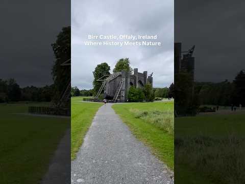
Birr Castle, Offaly Ireland #discoverireland

Birr Castle, Offaly Ireland #discoverireland

The Life of Stuff

Aghnameadle Castle →
Ahenny High Cross

Ahenny High Cross

Coastway

Ahenny High Cross →

All places in Tipperary

Showing 24 of 330 places

Devil's Bit Mountain — photo by Paddy Ryan▶ Video

Devil's Bit Mountain

The Devil's Bit or Devil's Bit Mountain (Irish: Bearnán Éile, meaning 'little gapped hill of Éile', historically anglicized as 'Barnane Ely') is a large hill in County Tipperary, Ireland, which rises to 480 metres (1,570 ft). It lies north-west of the town of Templemore. The mountain is usually climbed through the townland of Barnane. There is a car park at the base.

Keeper Hill — photo by Sarah777▶ Video

Keeper Hill

Keeper Hill or Slievekimalta (from Irish Sliabh Coimeálta, meaning 'mountain of guarding') is a mountain with a height of 694 metres (2,277 ft) in the Silvermine Mountains of County Tipperary, Ireland. Traditionally, it was deemed to be part of the Slieve Felim Mountains.

Loughmoe Court — photo by Rigger30
CastleTipperary

Loughmoe Court

Loughmoe Castle (Irish: Caisláin Luach Magh, also spelt Loughmore Castle) is a ruined castle in County Tipperary, Ireland. It is by Loughmore village, 5 km south of Templemore. The castle was the ancestral home of the Purcell family, the Barons of Loughmoe.

Shanbally Castle — photo by Wikimedia Commons contributor
CastleTipperary

Shanbally Castle

Shanbally Castle was located near Clogheen, County Tipperary and built for Cornelius O'Callaghan, 1st Viscount Lismore in around 1810. It was the largest house built in Ireland by the noted English architect John Nash. The castle was acquired by the Irish Land Commission in 1954. On 21 March 1960 the castle, after much controversy, was demolished.

Castle Otway — photo by Liam Hughes from Milwaukee, WI, USA
CastleTipperary

Castle Otway

Castle Otway is a former 18th-century country house which stood on a hill on the outskirts of Templederry, near Nenagh in County Tipperary, Ireland. The house was built in stone up against the ruins of Cloghane Castle in two storeys with a 7-bay frontage, of which the middle three were pedimented. In the 19th century a tower house was attached at the rear based on the ruins of the castle keep. The house was burnt down in 1922 during the Civil War, probably by anti-Treaty Republicans. It now stands as a derelict ruin with the gardens and estate land used for farming.

CastleRock of Cashel
CastleTipperary

Rock of Cashel

The Rock of Cashel (Irish: Carraig Phádraig [ˈkaɾˠəɟ ˈfˠaːd̪ˠɾˠəɟ]), also known as Cashel of the Kings and St. Patrick's Rock, is a historical site located dramatically above a plain at Cashel, County Tipperary, Ireland.

Ardfinnan Castle — photo by Mike Searle
CastleTipperary

Ardfinnan Castle

Ardfinnan Castle, is a castle built in 1185 with its sister Lismore Castle, by the river crossing at Ardfinnan (Ard Fhíonáin in Irish) in County Tipperary, Ireland. It is situated on the River Suir, four miles south of Cahir and seven miles west of Clonmel. One of the earliest Norman castles in Ireland, Ardfinnan and Lismore represent the oldest castles built by the Norman Crown in Ireland. The castle and grounds are a private residence and not open for public viewing. The Anglo-Norman castle is positioned on a large rocky incline above a ford in the river, looking out over the Suir valley with the Knockmealdown Mountains to the south, and the Galtee Mountains to the northwest. The castle is a parallelogram in shape with a fortified entrance gateway, keep and circular 13th century preceptory at its eastern corners, while to the west are ruins of two towers and a great hall. The full extent of its structure is hidden by the trees of the Castle Wood. The castle is bound at the riverbank, bridge and road by its old watermill.

CastleCahir Castle
CastleTipperary

Cahir Castle

Cahir Castle (Irish: Caisleán na Cathrach), one of the largest castles in Ireland, is sited on an island in the river Suir. It was built from 1142 by Conchobar Ua Briain, King of Thomond. Now situated in Cahir town centre, County Tipperary, the castle is well preserved and has guided tour and audiovisual shows in multiple languages.

Silvermine Mountains E Top — photo by Sarah777

Silvermine Mountains E Top

The Silvermine Mountains or Silvermines Mountains (Irish: Sliabh an Airgid) are a mountain range in County Tipperary, Ireland. The highest peak of the range is Keeper Hill or Slievekimalta at 694 metres (2,277 ft) high. Traditionally, the mountains were deemed to be part of the Slieve Felim Mountains. The village of Silvermines is located to the north of the mountains and has been a mining centre since the 17th century. There are three Special Areas of Conservation on the Silvermine Mountains; the Silvermine Mountains SAC is known for its Northern Atlantic wet heaths, with Erica tetralix and species-rich Nardus grassland; the Silvermines Mountains West SAC is known for its Northern Atlantic wet heaths, with Erica tetralix, and its European dry heaths and Calaminarian grasslands where the levels of heavy metals, such as lead, are high, and are toxic to many plant species; and Keeper Hill SAC, known for its Northern Atlantic wet heaths with Erica tetralix and blanket bogs.

Mitchelstown Cave — photo by Martin Richard Phelan

Mitchelstown Cave

Mitchelstown Cave is a limestone cave near Burncourt, County Tipperary, Ireland. Situated 12 kilometres (7.5 mi) from Mitchelstown, County Cork, it became the first cave in Ireland to be developed for the public in 1972. The cave is located near Mitchelstown, County Cork, but is actually in County Tipperary . It is a local landmark and tourist destination, with a number of caverns open to the public through a guided tour. Noteworthy speleothems include the Tower of Babel column. The largest cavern, known as the Tír na Nóg has hosted concerts and events.

GeneralOrmonde Castle
GeneralTipperary

Ormonde Castle

Ormond Castle (Irish: Caisleán Urmhumhan) is a castle on the River Suir on the east side of Carrick-on-Suir, County Tipperary, Ireland. The oldest part of the existing castle is a mid-15th century walled bawn, cornered on the northeast and northwest by towers.

Kilcooly Abbey — photo by Edvardforeve

Kilcooly Abbey

Kilcooley Abbey is a Cistercian abbey near the village of Gortnahoe in County Tipperary, Ireland. The abbey is located inside the grounds of the Kilcooley Estate. This abbey dates from 1182 when the King of Thomond Donal Mor O’Brien granted lands to the Cistercians, to build an abbey here. The abbey, which was built around 1200 is dedicated to the Virgin Mary and St. Benedict and shares similar Cistercian architecture with both Jerpoint Abbey and Holy Cross Abbey. The abbey is open to the public. After the Reformation and the dissolution of the monasteries, Kilcooley passed into the possession of the Earl of Ormond. It was granted to the English-born judge Sir Jerome Alexander in the 1630s. It passed to his daughter Elizabeth, and then through marriage to the Barker baronets of Bocking Hall, the last of whom died in 1818.

Tipperary Museum of Hidden History — photo by Sheila1988
MuseumTipperary

Tipperary Museum of Hidden History

The Tipperary Museum of Hidden History is a local history museum in Clonmel, County Tipperary, Ireland. It is designated as museum by the National Museum of Ireland and has full accreditation in the Museum Standards Programme for Ireland (MSPI).

Monaincha Abbey — photo by Martin Carroll Ireland
ChurchTipperary

Monaincha Abbey

Monaincha Church is a 12th-century church in Roscrea, County Tipperary, Ireland. It is registered as National Monument number 125.

AbbeyHolycross Abbey

Holycross Abbey

Holy Cross Abbey (Mainistir na Croise Naofa) was a Cistercian monastery in Holycross near Thurles, County Tipperary, Ireland, situated on the River Suir. It takes its name from a relic of the True Cross or Holy Rood.

AbbeyHore Abbey

Hore Abbey

Hore Abbey (also Hoare Abbey, sometimes known as St Mary's) is a ruined Cistercian monastery near the Rock of Cashel, County Tipperary, Ireland. 'Hore' is thought to derive from 'iubhair' – yew tree. The former Benedictine abbey at Hore was given to the Cistercians by Archbishop David Mac Cerbaill (in 1270), who later entered the monastery, and was buried there in 1289. He endowed the Abbey generously with land, mills and other benefices previously belonging to the town. A story that is much cited by tour guides is that he evicted the Benedictines after a dream that they were about to kill him. This is unlikely to be true and probably arises from the Archbishop's 'interference' with the commerce of the city of Cashel. His disfavour of the established orders in Cashel certainly caused local resentment. He was resented by some of the townspeople, being considered too much in favour of the Irish by the more Anglicised. This is evident in the objection by the thirty-eight local brewers to the levy of two flagons out of every brewing and in the murder of two monks who were visiting the town. He was by all accounts an exceptionally quarrelsome man, who in his long career clashed with the Dean of Cashel, his fellow bishops and the Dublin administration.

Knocknamuck — photo by David Purchase

Knocknamuck

Knocknamuck (Irish: Cnoc na Muc) is a mountain in County Tipperary, Ireland.

AbbeyAthassel Priory

Athassel Priory

Athassel Priory ( a-TASS-əl) is the largest medieval priory in Ireland, stretching over a 4-acre (1.6 ha) site. The priory dates back to the late 12th century when it was founded by the Augustinians under the patronage of William de Burgh (founder of Ireland's Burke Dynasty). William's grandson Hubert de Burgh, (or Burgo) later the Bishop of Limerick, was prior at Athassel c. 1221. The original buildings were altered and renovated over the next 300 years. The priory was burnt twice, once in 1329 by Brian King of Thomond and again in 1581 by John Fitzgerald of Desmond. A large town had grown up around the priory but was destroyed during the two raids. The priory was finally dissolved in 1537 and the lands given to Thomas Butler, 10th Earl of Ormond, who neglected the abbey, and it subsequently fell into ruin.

CastleKilcash Castle
CastleTipperary

Kilcash Castle

Kilcash Castle is a ruined castle off the N24 road just west of Ballydine outside the village of Kilcash in County Tipperary, Ireland. It is in the care of the Irish State. The Butler dynasty has important links to the area.

CastleRoscrea Castle
CastleTipperary

Roscrea Castle

Roscrea Castle is a 13th-century motte-and-bailey castle in the town of Roscrea, Ireland. The castle consists of a walled courtyard, gate block, and angled towers. Along with 18th century Damer House and gardens, the castle forms part of Roscrea Heritage Centre.

More counties in Munster